Mammoth Lakes is a remote area in the Eastern Sierra Mountains (one of my favorite places) with a population of 8,000 and an altitude of 8,050 feet. It is located just 45 minutes from Yosemite National Park and 3 hours from Death Valley National Park. Although Mammoth Lakes is remote, it is a full-service community with two grocery stores, a hospital, shopping, dining, and trendy bars. In this blog post, I will walk you through a list of things to do in Mammoth Lakes. You will be amazed at some of the other worldly spots. So are you ready?! Let’s go!
Why Mammoth Lakes?
Mammoth Lakes is the gateway town into the Eastern Sierra. There are jaw-dropping hiking trails, not to mention backcountry exploration in this area. Don’t feel like working out? No problem. The lake district has plenty of fishing, kayaking and star gazing to keep you occupied. Or are you more the hot springs type of person? Mammoth has that too! And if that still doesn’t sound adventurous, a drive down to the Hot Creek Geologic Site will make your jaw drop. While you’re there, drive a little further and check out the Tuffas at Mono Lake, I guarantee you will be pleased.
Where is Mammoth Lakes?
From San Francisco, the usual route is through 120 Tioga Pass via Yosemite. It’s the quickest way to get to Mammoth Lakes and should take you around 5.5 hours barring any construction, or traffic. Tip: Sometimes Yosemite National Park will require a day reservation, even if you are only driving through the park. Check requirements before your trip.
What to do in Mammoth Lakes?
DAY 1
You can organize your days any way that best makes sense for your schedule. Here is a rough idea of how you can go about your weekend in Mammoth Lakes.
If you’re a sunrise type of person, get to the Hot Creek Geologic Site early morning and then begin your day with fly fishing at 9am.
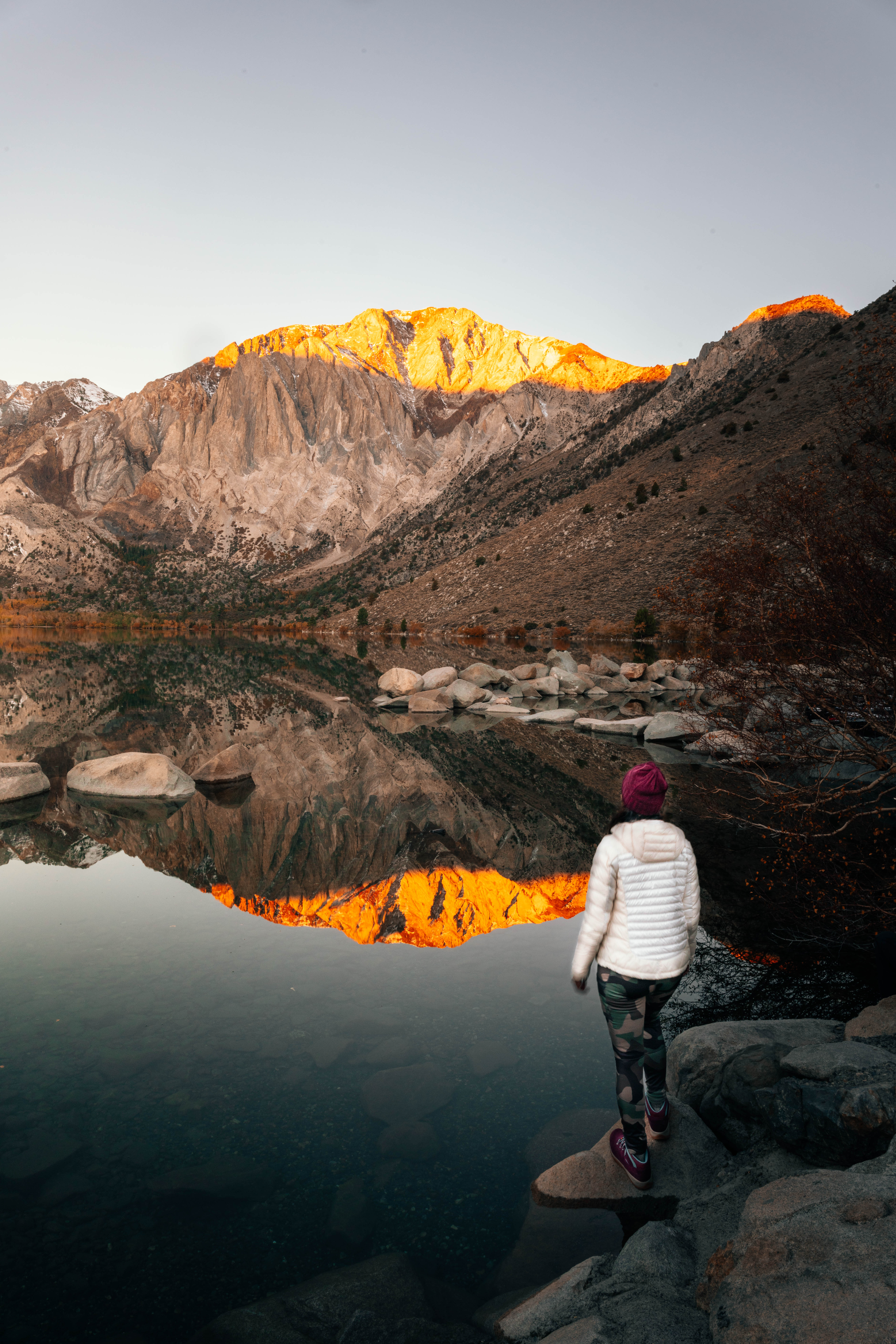
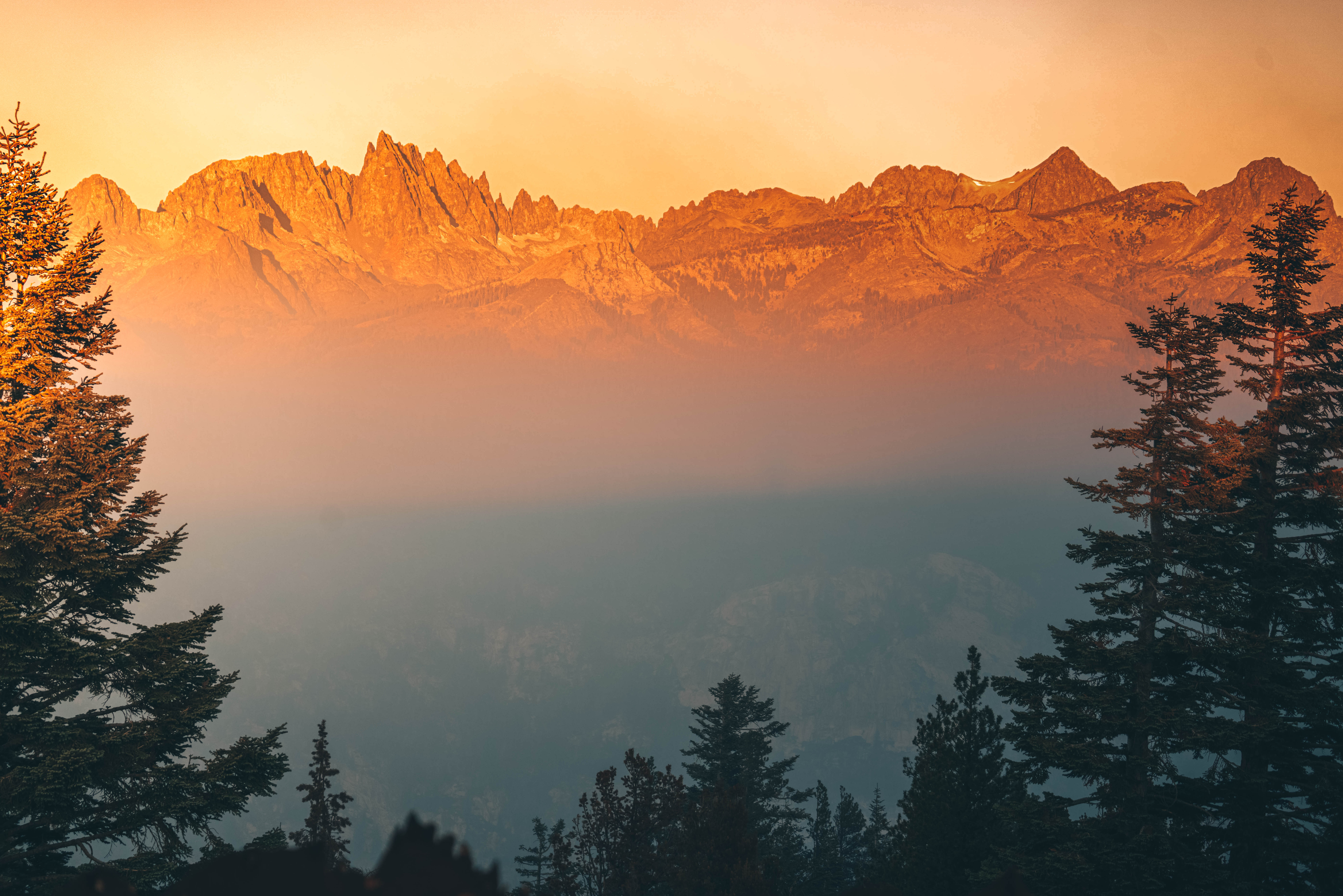
Hot Creek Geologic Site
Hot Creek is a place to marvel at geology in action at Mammoth Lakes. Boiling water bubbling up from the creek bed, fumaroles and periodic geyser eruptions at Hot Creek attest to the chamber of hot magma which lies about three miles below the surface of the earth in this area. Tip: Sunrise or sunset gives you the best light for photography.
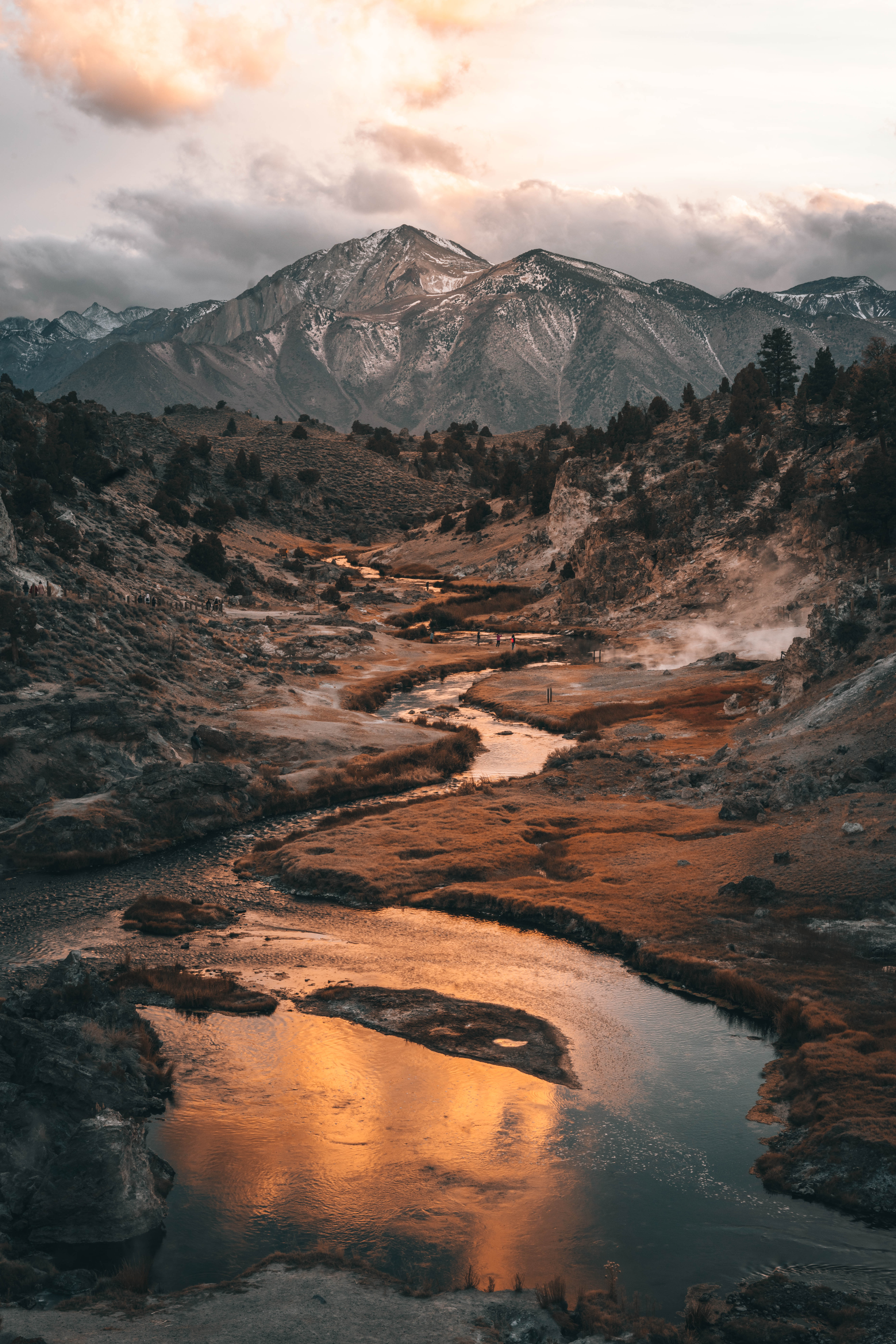
How is the steam created?
The steam you see along the Hot Creek drainage is created when water percolates deep into the ground and enters a complex underground plumbing system. The water is heated and pressurized before it rises to the earth’s surface. It is believed this journey takes around 1000 years.
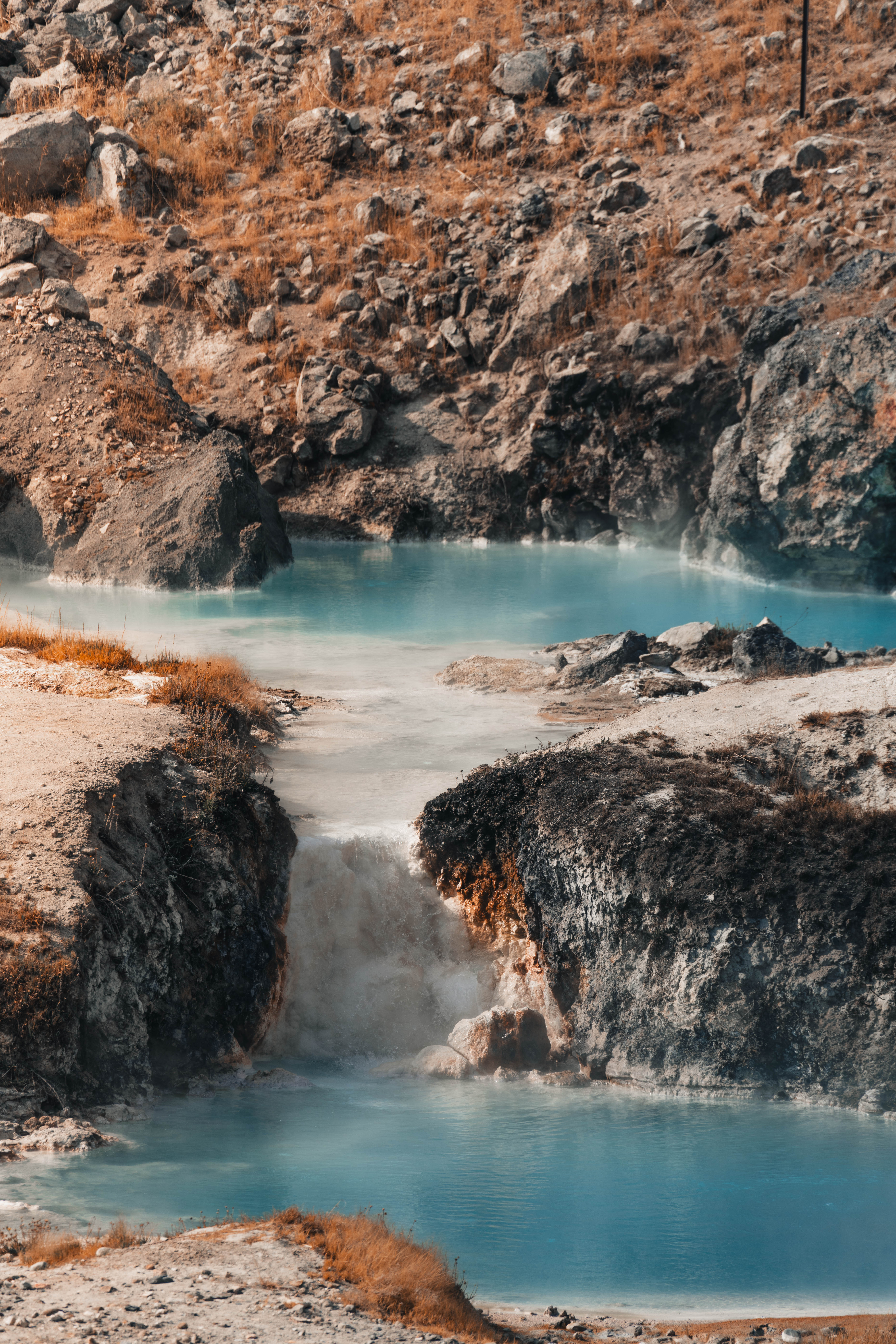
Can I soak in the hot creek?
Earthquakes can cause sudden geyser eruptions and overnight appearances of new hot springs at Hot Creek. Water temperatures can change rapidly, and so entering the water is prohibited.
Can I get close to the hot springs?
Option 1
You sure can! After driving about 3 miles on a dirt road, you’ll come to the parking lot. Here you will find an overlook, if you don’t feel like walking down to the creek. The overlook is a pretty neat spot to see the creek and bubbling pale blue pools of water. From the overlook, it’s about a 1/2 mile easy hike down a path to the creek. The bubbling pools here reminded me of the Cold Boiling Lake in Lassen Volcanic National Park. Heed the signs to not enter the water please, leave no trace, and come back the way you came down.
Option 2
Once you’ve parked your car in the parking lot, walk past the parking lot and to Brees lookoutn (just nav yourself by walking there). Here you will be able to see the entire windy creek and the mountains. It’s a postcard view of the Hot Creek.
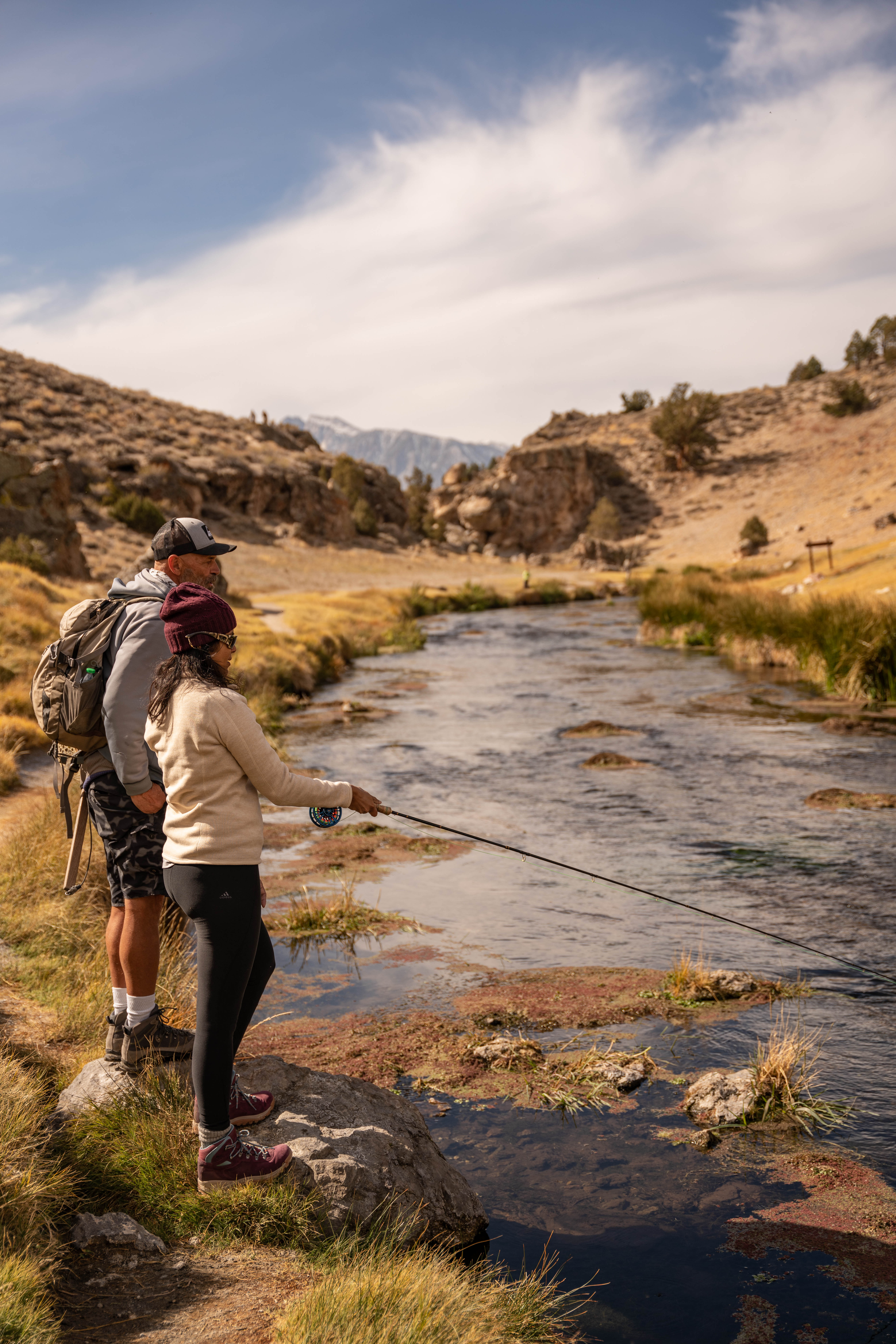
Fly Fishing in Mammoth
I grew up in India so fly fishing is not part of my culture or dna 🙂 I first fly fished in Idaho earlier this year and the experience was very unique. I can best describe fly fishing as meditative and it deeply connected me to nature, especially the river and the flow. Not so much the fish necessarily as many experienced fly fishers claim. But, I would say, if you’re even a little interested in fishing, give fly fishing a try. The catch and release method is practiced in many areas like Mammoth Lakes’ Hot Creek.
The process
I fly fished in Mammoth Lakes with a local outfitter Troufitter. You meet at the store to get your one-time fly fishing license. The total cost of guide plus equipment is anywhere from $300-$350 for a 5-hour half-day trip. A full day trip is 8 hours. Once you get your license, you will follow your guide to the Hot Creek. After a short hike, your guide will settle down in what he deems to be a good spot to begin fishing. In the Hot Creek, you don’t actually step into the river so as to protect the habitat. You fish from the banks of the river so you can pretty much wear whatever you want, depending on the weather. Wear good hiking shoes.
Mono Lake
Utah isn’t the only state with mars like formations 🙂 Come to Mono Lake. It’s other worldly! The unusual rock formations around Mono Lake are known as tufa. Tufa towers are beautiful, but they are also important habitat, from nesting sites for Osprey and owls to underwater habitat for alkali flies. Tip: Sunrise and sunset are incredible here if you want to photograph in the best light.
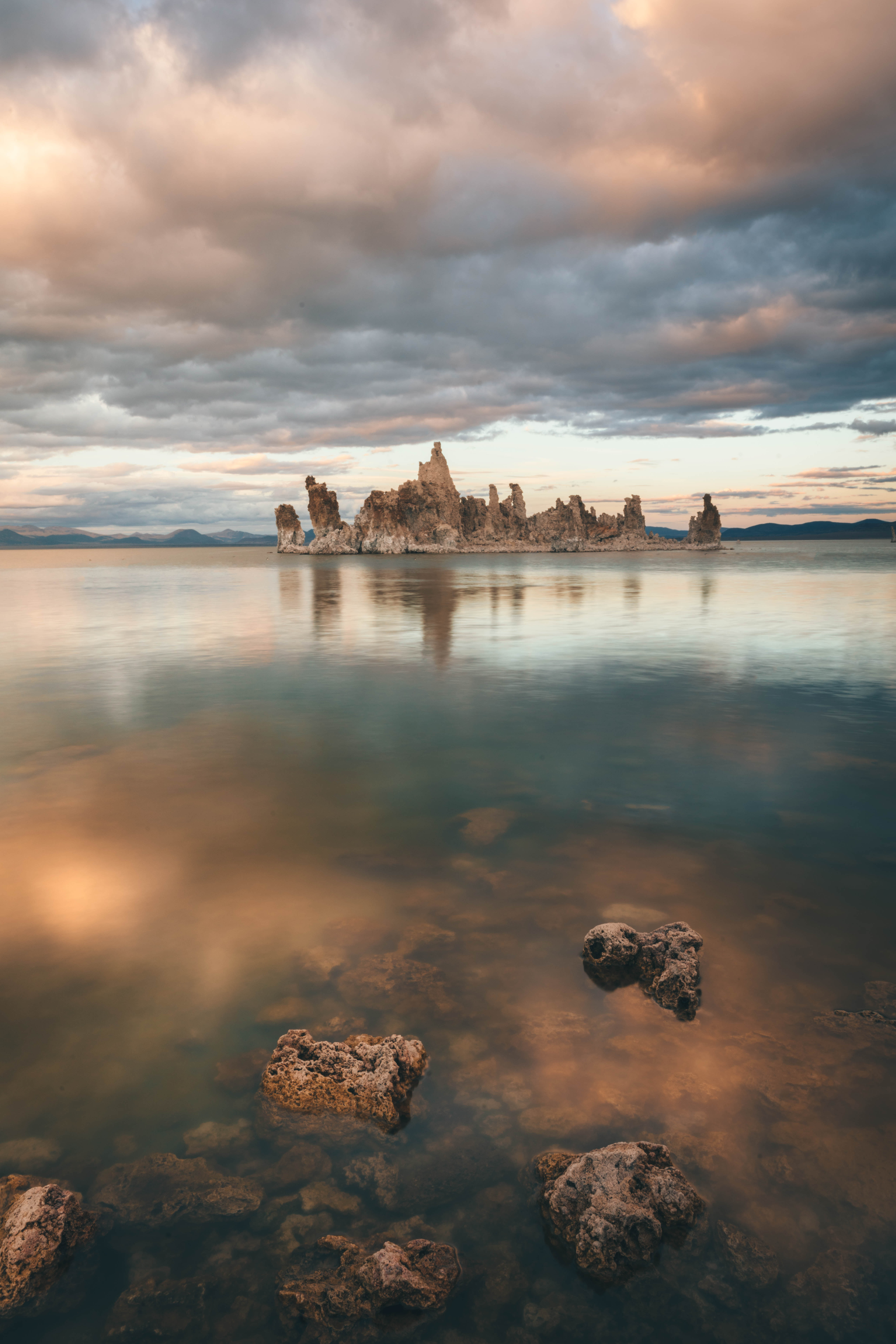
How did the tufas form?
All tufa at Mono Lake forms underwater. Beneath Mono Lake, calcium-rich freshwater springs seep up from the lake bottom and mix with lake water rich in carbonates (think baking soda). As the calcium comes in contact with the carbonates in the lake, a chemical reaction occurs, resulting in calcium carbonate, or limestone. The calcium carbonate precipitates (settles out of solution as a solid) around the spring, and over the course of decades to centuries, a tufa tower will grow. Tufa towers can grow to heights of over 30 feet underwater.
Is the tufa growing?
The reason visitors see so much tufa around Mono Lake today is because the lake level fell dramatically after excessive water diversions by the Los Angeles Department of Water & Power began in 1941. Once above the waterline, tufa can no longer grow and are susceptible to erosion.
Best place to see the tufas?
South Tufa is the best spot from where you can see the tufas. There is a parking lot from where you can walk through a boardwalk to get to the edge of the lake to see the tufas.
How to help save the crumbling tufas?
Though tufa towers are rock formations, they are fragile—they crumble, topple, and erode from wave action, high desert weather, and, unfortunately, from people being careless around them. To protect these fragile formations, the Mono Lake Tufa State Reserve was established to help preserve and protect these unusual formations.
When you visit Mono Lake you can help save the tufa by enjoying and taking photos of the spectacular formations from the ground, rather than standing or climbing on them. Also, make sure others in your group know to be careful around the fragile tufa.
DAY 2
Begin day 2 with an 8am aerial ride through Mammoth!
Helicopter Ride through Mammoth Lakes
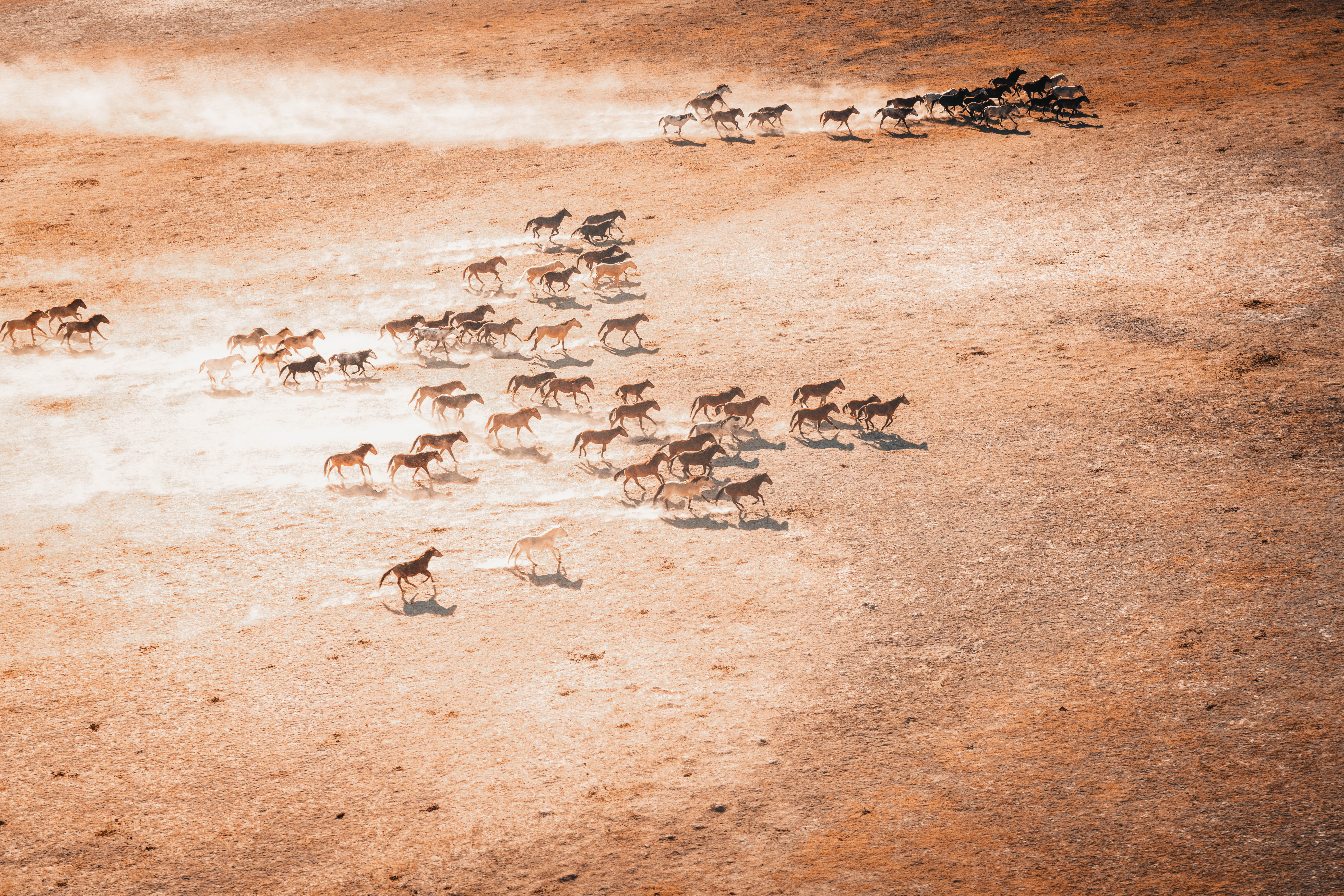
I chose to ride with SkyTime Helicopter Air Tours in Mammoth Lakes. A tour can cost anywhere from upwards of 88$ depending on what you want to see. My favorite part of this tour was that it was doors off, meaning it was perfect to take photographs without the glare of a window against the sunlight. At first as the helicopter was taking off, I was a bit scared because of the height, but as the tour continued, I began to feel at ease. I saw the Minarets range (the backdrop of Mammoth), Thousand Island Lake (the largest backcountry lake in the Sierra), Mammoth Lakes, Convict Lake, wild horses running, and the Hot Creek bubbling pools from above. It was surreal and amazing to see the region from an aerial perspective. Don’t miss this!
After the helicopter ride, drive to the Mammoth Lakes Basin.
Biking in Mammoth Lakes
Biking in Mammoth is a fun activity for everyone, including family! To figure out what kind of bike you need, click on this link.
The Lakes Basin Path is a good choice for biking around the lakes. You don’t have to bike the entire path, but know that there are flat and uphill stretches on this route. This ride is a steady 5.3-mile climb up to the Lakes Basin, passing Twin Lakes, Lake Mary, and Lake Mamie on the way to its endpoint at Horseshoe Lake. The scenic views encompass the Mammoth Crest and the back side of the Sherwin Range. A moderate fitness level is needed, so be sure younger children are up to the challenge. A bicycle with gears is a good choice; riding a single-speed will increase the difficulty level. Bathrooms and water are available at the Twin Lakes General Store. On your return trip, be courteous to uphill riders, obey the 15 mph speed limit, and be sure you have a set of good brakes!
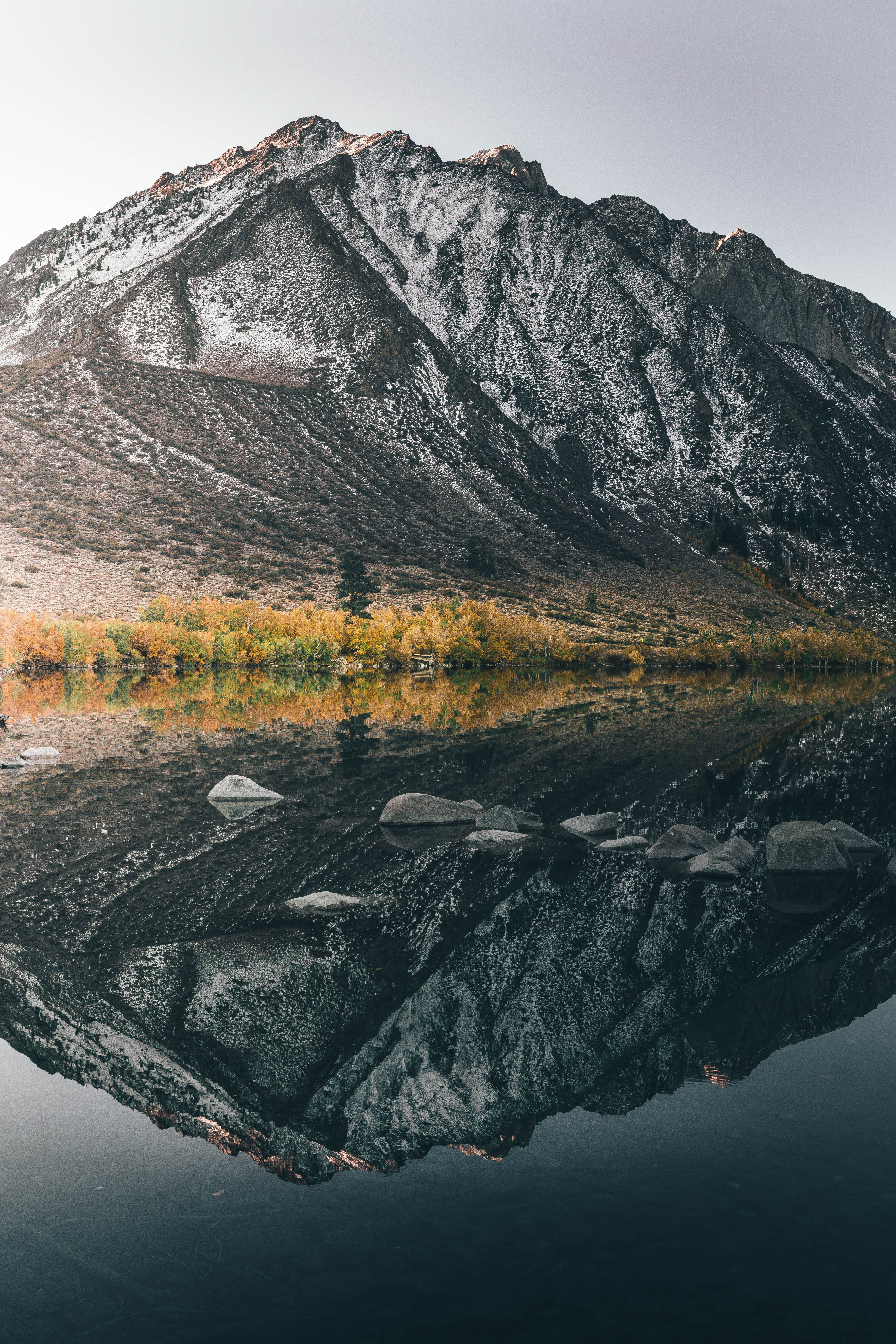
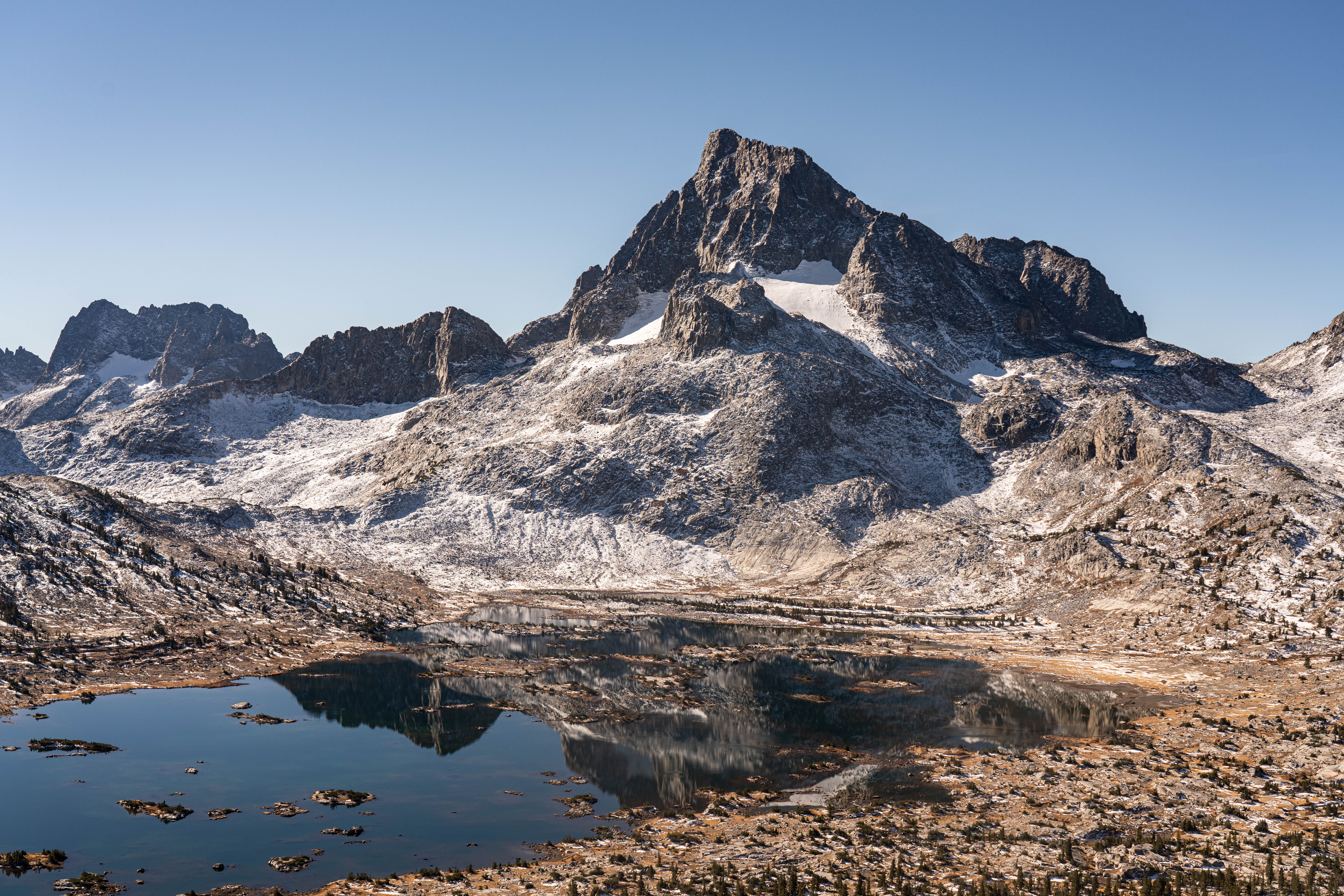
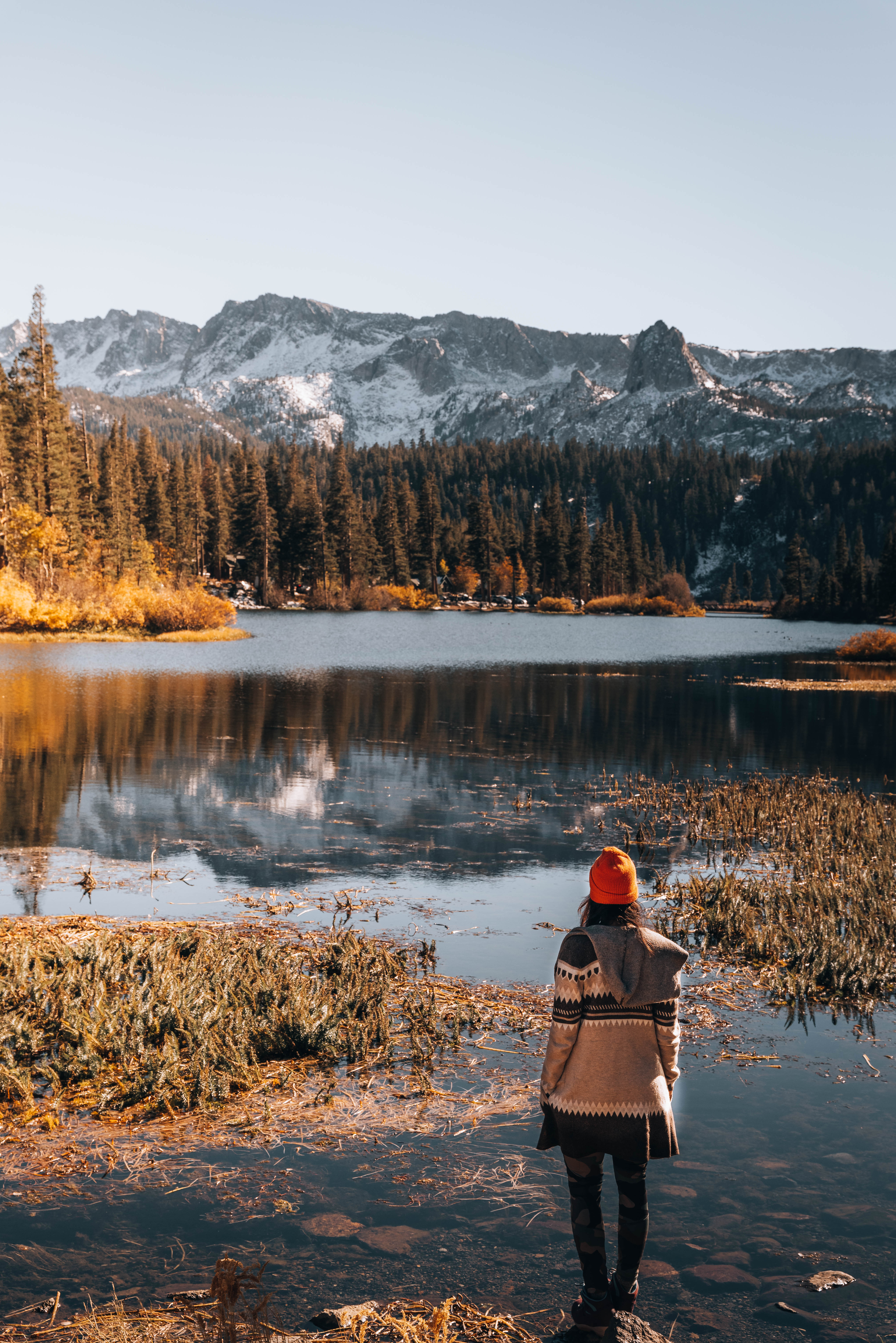
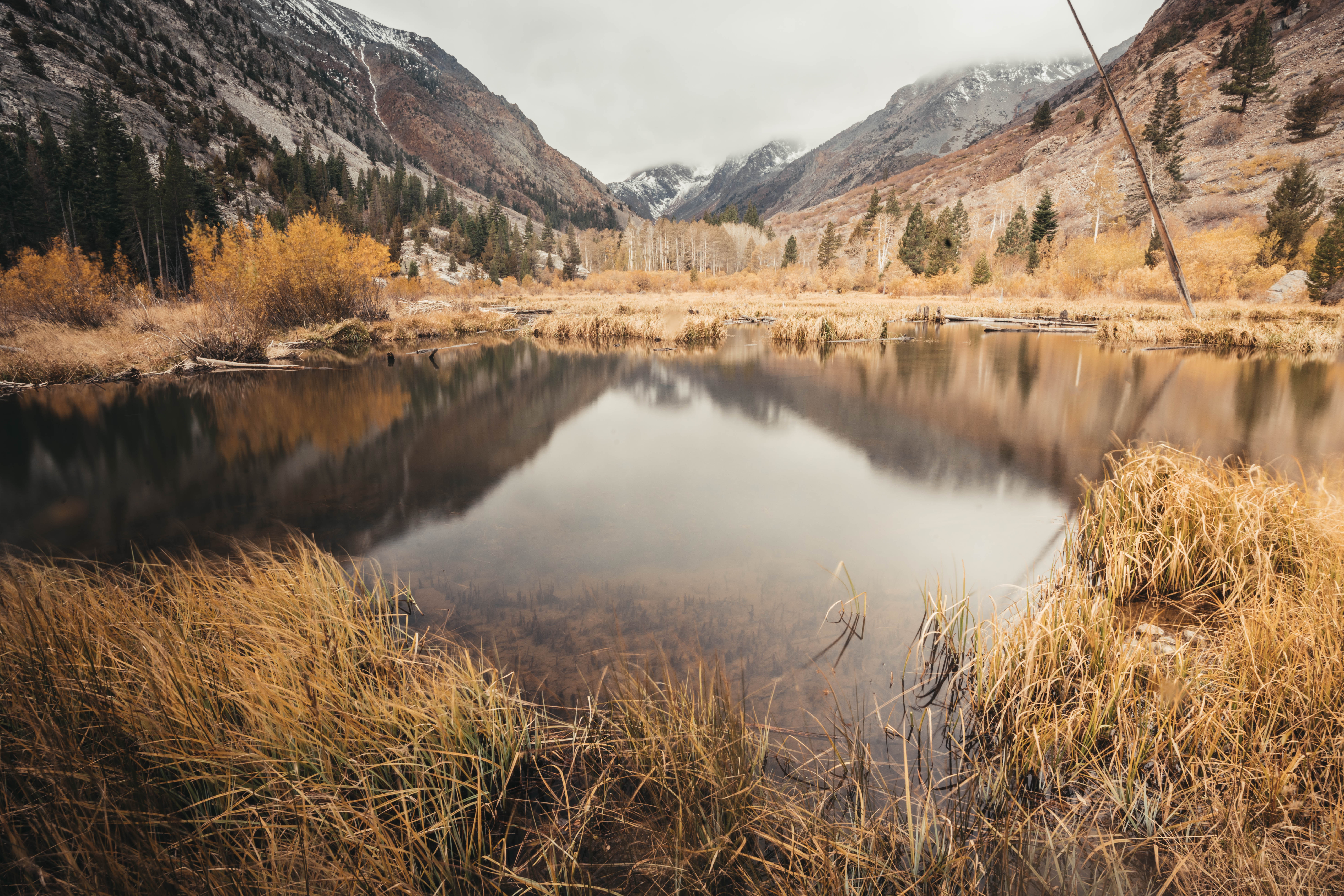
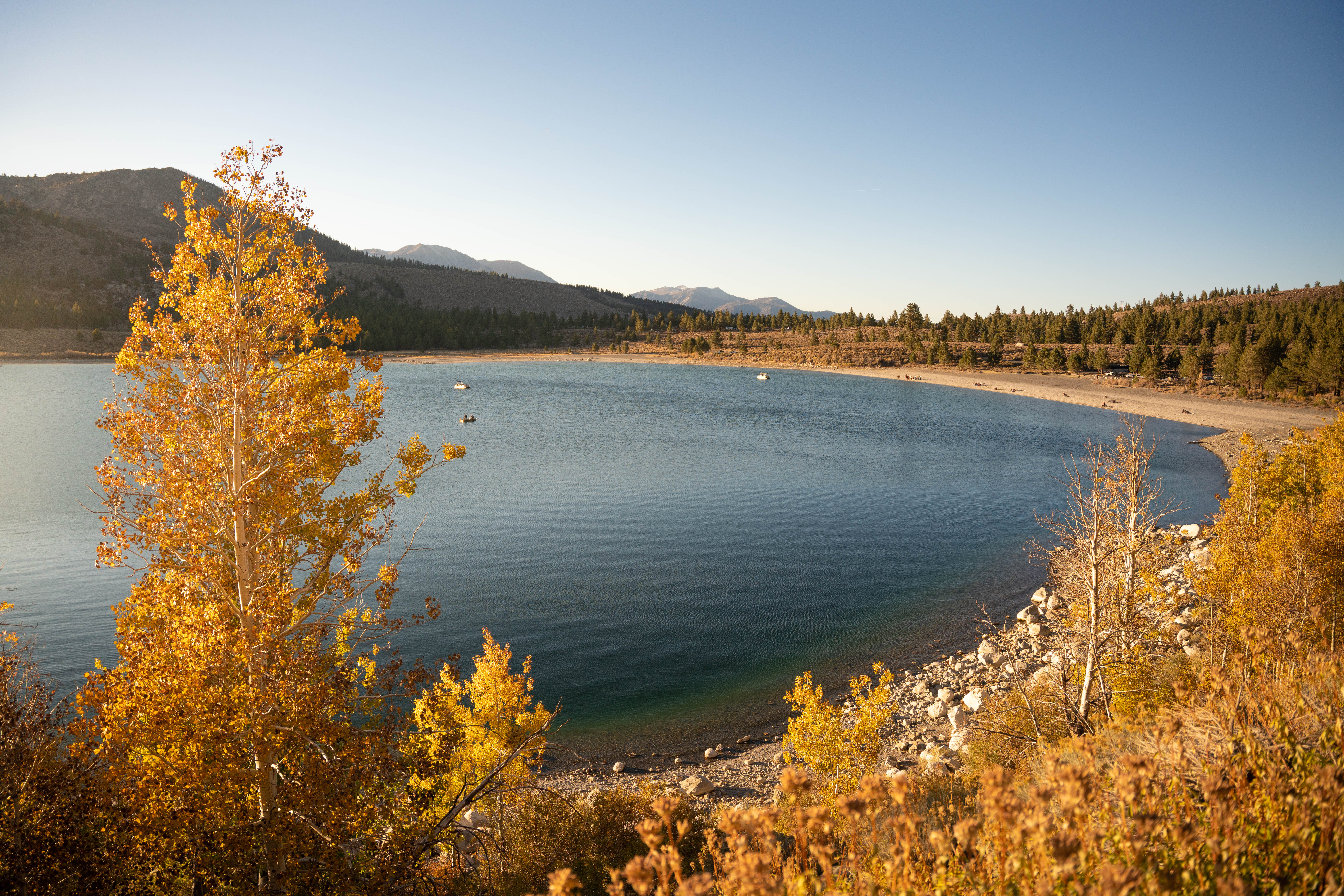
Mammoth Lakes Basin
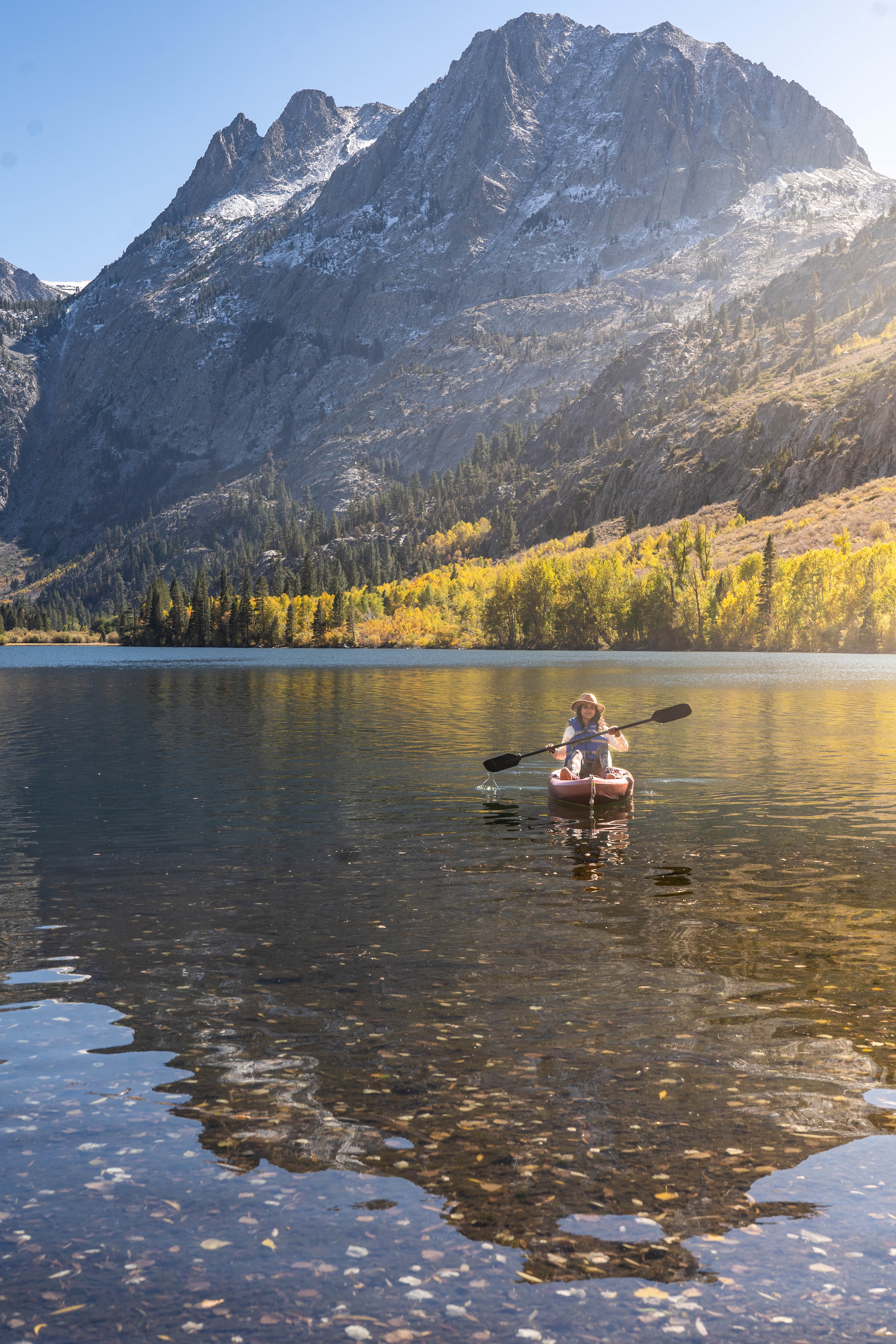
My favorite thing to do here at Mammoth Lakes is to hike, or kayak or just laze around on the banks of a lake with a good book/food 🙂 All the lakes in the lake basin are nestled below jagged peaks and pine forests. You can drive or bike to Twin Lakes, Horseshoe Lake, Lake Mary, Lake Mamie and Lake George.
Hiking trails
Crystal Lake is a stunning 3.1mi out and back hike (think gradual uphill) to an alpine lake with jagged peaks for a backdrop. Don’t miss this hike!
If you still have time left in the day, you can drive to any of these other areas below and just walk around. For more hiking trails around Mammoth, read my post here.
Other Lakes & hikes near Mammoth Lakes
- Convict Lake
Convict Lake is one of my favorite lakes in Mammoth Lakes. Just about 25 minutes away from Mammoth Lakes, Convict Lake is filled with water as clear as glass, and has an easy three-mile long trail that you can hike around the lake. The backdrop is the Sierra Nevada 12,241′ peak Mount Morrison! Convict Lake was originally carved out by glaciers, and at up to 140’ deep in some places, it’s one of the deepest lakes in the region. So what does that mean for you? Spend at least half a day here, either kayaking/canoeing out on the lake and/or hiking the loop. You won’t regret it.
- McGee Creek
If you continue past Convict Lake, just off of Highway 395 is a classic Eastern Sierra canyon called the McGee Creek area where you can camp, fish and hike! When you nav to McGee Creek, and enter the area, be sure to stop at the small bridge to check out the creek. Then carry on past the McGee Pack Station, to a parking lot.
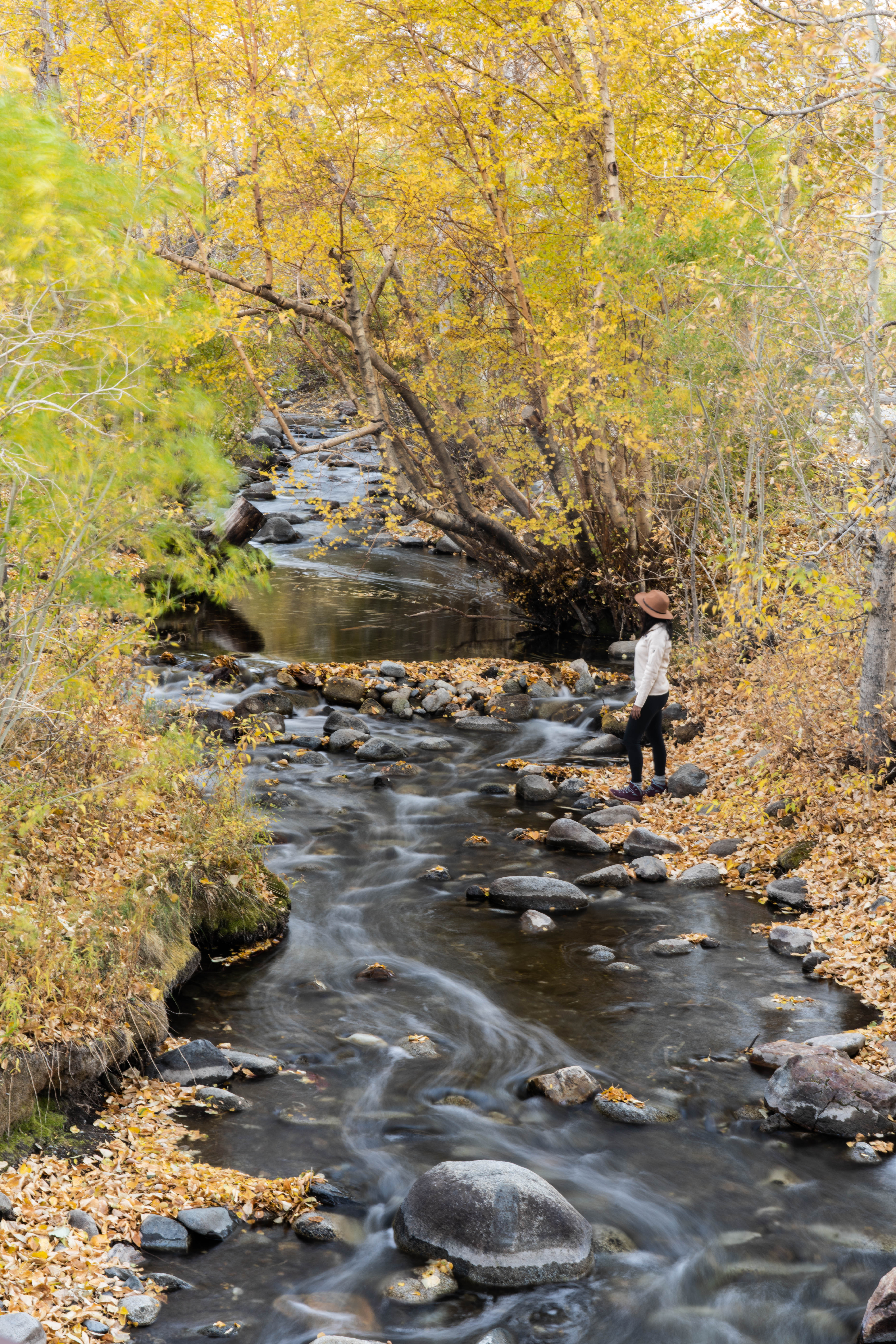
The hike
A classic meadow-to-peaks trail for prime wildflower viewing, McGee Creek Trail offers stunning views of surrounding mountains, nearby Crowley Lake and spectacular fall colors. This out-and-back trail is moderate to difficult and best hiked through mid July to mid September. With 2,280 feet of elevation gain, this hike is one that should be attempted only after being in the area for a few days. You can make a day hike out of it by following the trail 5 miles up to Steelhead Lake or 7 miles up to McGee Lake. Access the trailhead west off Hwy. 395 about eight miles south of Mammoth.
- Rock Creek
Continue past McGee Creek and you should come to the exit for Rock Creek. Rock Creek Road follows Rock Creek from Highway 395 by Tom’s Place up nearly 3,000’ and a dozen miles to the Mosquito Flats parking lot, some 10,320’ above the sea. About a mile before the road dead ends is where you can find Rock Creek Lake, perfect for fishing. There is also a campground if you wish to camp.
If you go toward the other side of Mammoth Lakes Basin, toward Mono Lake, here are the following areas to see:
- Lundy Canyon
If you head in the direction toward Mono Lake, there is an area here called Lundy Canyon. The drive into the canyon is absolutely gorgeous.
The Hike
Lundy Canyon Trail is about 3 miles, beginning at the end of Lundy Lake Rd. It’s an out-and-back journey into a vibrant canyon landscape brimming with Eastern Sierra life and scenery, including a waterfall and beaver dam. Level of difficulty is moderate-to-intense. Extend the hike to Lake Helen, 20 Lakes Basin, Saddlebag Lake and the eastern edge of Yosemite. To find the trailhead, take Hwy. 395 seven miles north of Lee Vining and go west. Follow Lundy Lake Rd. for about two miles.
- June Lake Loop
The June Lake loop is one of my favorite areas in Mammoth! This is also in the same direction as Mono Lake. Check out the 4 lakes that form the beautiful June Lake Loop. This is also home to a fantastic campground, one of my favorites, called Gull Lake Campground.
- Devils Postpile
Devils Postpile is a Mammoth Lakes must do activity! Resembling a tidy lumber pile created by giants, Devils Postpile’s 60-foot basalt columns were formed when lava erupted in the valley nearly 100,000 years ago and filled the area to a depth of 400 feet. Then, glaciers overrode the fractured mass of lava and quarried away one side of the postpile about 10,000 years ago, exposing and polishing a sheer wall of columns and enhancing the appearance of the natural hexagonal structure.
How to hike to Devils Postpile
Visitors can hike 8 miles of trails at Devils Postpile National Monument and can also choose to venture outside the landmark’s boundaries to the Ansel Adams Wilderness. To hike Devils Postpile, take the half-mile trail to the base, then continue uphill to the formation’s summit for incredible views. Or ramble the 2.5-mile route from the ranger station to 101-foot Rainbow Falls, the perfect spot for a mid-afternoon picnic.
Tip: Access is from mid-June to mid-October.
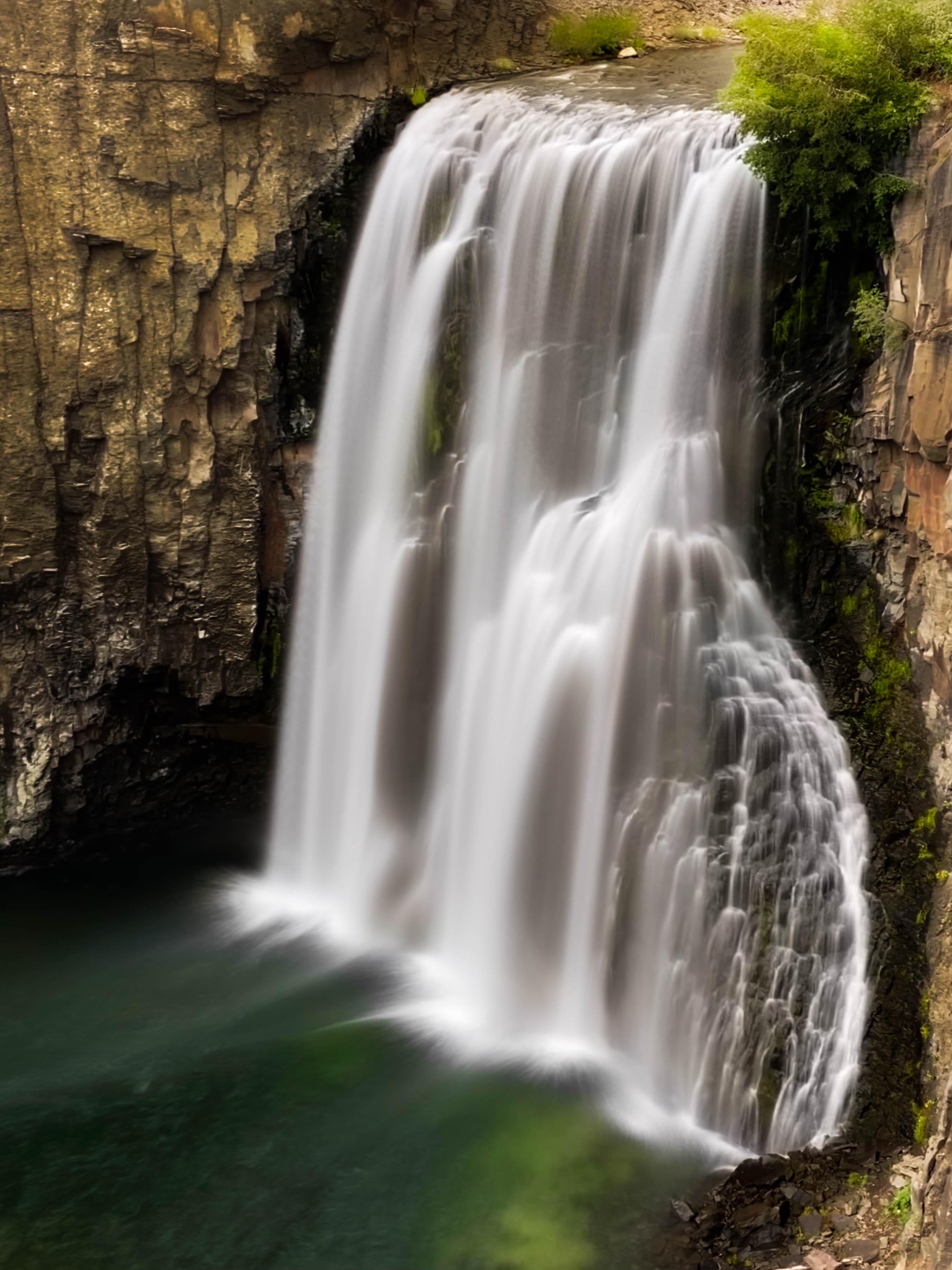
- Rainbow Falls
Rainbow Falls is part of the Devils Postpile National Monument. It’s known for the rainbows that the mist creates, especially on a sunny day. The mandatory shuttle is operated by Eastern Sierra Transit and boards at Mammoth Adventure Center. Personal vehicle travel is allowed outside of the shuttle season. Rainbow Falls is an easy 2.5 mile walk from the trailhead at Devil’s Postpile National Monument OR you can also just take the shuttle to stop #9 and walk from there (it’s a shorter hike). Tip: Visit middle of the day when the sun is at its highest if you want a chance of viewing the rainbows at the waterfall.
Vistas
Apart from Brees Viewpoint mentioned above, if you have time, catch a sunrise or sunset at Minarets Vista in Mammoth Lakes. The vista offers a breathtaking view of Mammoth Lakes’ signature skyline, the Minarets, which are part of the Ritter Range. In summer, you can also hike up to the viewpoint. The trail is located within Mammoth Mountain Ski Area but open to the public with no fee required, this trail starts from behind the Mammoth Mountain Inn and climbs gently for 1.5 miles through a forest of red fir and lodgepole pine, following the course of Minaret Road to the parking and picnic area at Minaret Vista.
Hot Springs
As you can see, there is a lot of things to do in Mammoth Lakes, including soaking in some hot springs after a hike! Here are the top five free ones:
Tip: Check road conditions before you go to these hot springs! Some of the roads may be closed in winter or during heavy rains.
List of free hot springs:
- Buckeye Hot springs: Located an hour north of the Mammoth Lakes hot springs, there are multiple pools here so check all of them out! Coordinates for Buckeye Hot Springs: 38°14’20.3″N 119°19’31.6″W (open in Google Maps here). Parking coordinates: 38°14’23.1″N 119°19’32.8″W (open in Google Maps here)
- Travertine Hot Springs: Located an hour north of Mammoth Lakes, this one is a gem! There are the main pools and then more secret pools the further you walk. Coordinates for Travertine Hot Springs: 38°14’43.3″N 119°12’18.8″W (open in Google Maps here). Parking coordinates: 38°14’44.6″N 119°12’14.8″W (open in Google Maps here)
- Wild Willy’s Hot Springs: Watching sunrise from Wild Willy’s hot springs is awesome! Fits up to 40+ people between both the pools. From the parking lot, follow the gravel and wooden boardwalk through meadowland to reach the hot springs. Please stay on the trail as the surrounding environment is fragile! Coordinates for Wild Willy’s Hot Spring: 37°39’40.4″N 118°46’03.8″W (open in Google Maps here. Parking coordinates: 37°39’33.0″N 118°46’16.2″W (open in Google Maps here)
- Hilltop Hot Springs: Little less natural appearance than the other hot springs listed, you can adjust the temperature of the water here. Best at sunset! This hot springs is reached via a short boardwalk from the parking lot. Fits 6-8 people. Coordinates for Hilltop Hot Spring: 37°39’50.3″N 118°47’21.8″W (open in Google Maps here). Parking coordinates: 37°39’37.4″N 118°47’19.9″W (open in Google Maps here)
- Rock Tub Hot Springs (Whitmore Hot Springs): Requiring no hike at all, Rock Tub Hot Spring is conveniently located right next to the parking lot. It is also the closest to Mammoth Lakes (just a 15-minute drive from the town). Fits 2-4 people. Coordinates for Rock Tub Hot Spring: 37°38’51.4″N 118°48’28.9″W (open in Google Maps here). Parking coordinates: 37°38’51.4″N 118°48’28.9″W (open in Google Maps here)
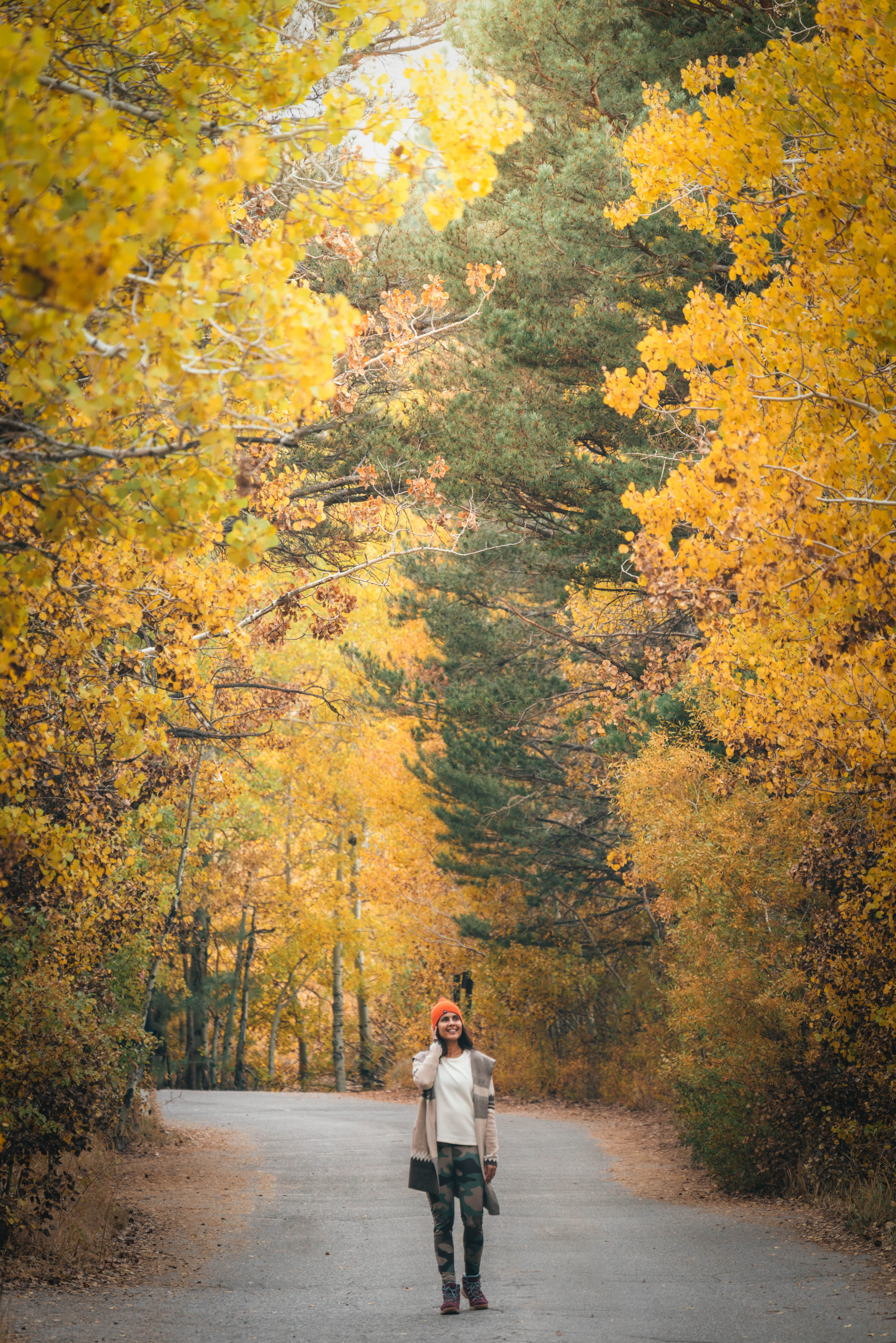
Best time to visit Mammoth Lakes
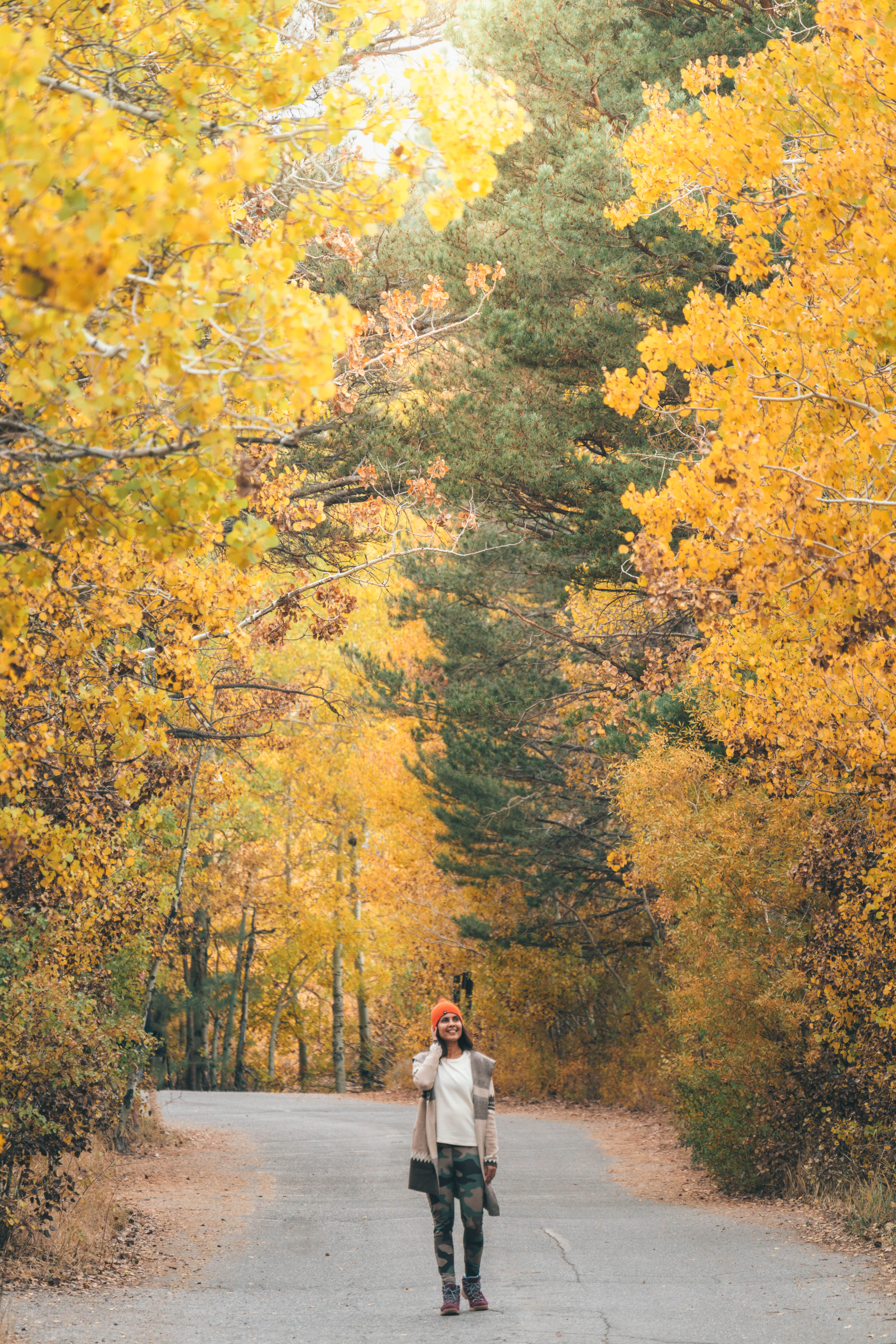
My favorite time to visit Mammoth Lakes is the fall season. The colors are a brilliant yellow. The months of September, October, November are considered off-season, meaning fewer tourists and cheaper hotel prices. November through April is perfect for skiing (Mammoth Lakes and Bishop is the California’s largest skiing center after Tahoe Lake), summer is great for fishing, biking, wildlife watching, and golfing. Note, in summer, weekends can be packed at Mammoth Lakes. If you use this guide, please leave a comment and let me know if you found this post useful, thank you for stopping by!


12 Responses
Really nicely written, so informative!!
Thank you and I hope you found what you wanted 🙂
Do you think this is doable in December?
Hi, yes not all of it, but some of it will be, depending on level of snow and road closures, so check conditions closer to your departure. Especially with Visit Mammoth’s IG page – they post updates there as well!
How is Mammoth Lakes only 45 minutes from Yosemite NP? Or are you still in your helicopter?
As you leave Yosemite and get on the 395 it’s 45 minutes to the first stop in Mammoth Lakes ..
any car camping sites in eastern sierra?
Tons! Try the areas around June Lake! https://www.californiasbestcamping.com/inyo/inyo_north_camping_map.html
Hi Preethi! I can’t wait to atleast visit half the places you mentioned here. I’m going to Mammoth lake this weekend and I’m even more excited after reading your blog, and also your ig posts and stories. Thank you for a very detailed informative blog. Take care 🙂
Yay I’m SO happy to hear that, have a great time !!!